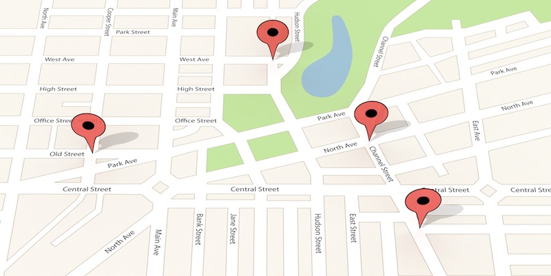
For a municipality or utility, a Geographic Information System (GIS) is more than a technology platform: it's the organization's single source of truth.
Field crews rely on it to locate critical assets, planners use it to guide infrastructure projects, and emergency dispatchers depend on accurate routing when every minute matters. When the data people depend on isn’t correct, the pressure falls squarely on the GIS department. And that may mean you—and you alone.
Building and maintaining a reliable basemap can quickly become a full-time job, with too many GIS professionals spending more time cleaning datasets, fixing topology, and chasing updates than applying their expertise to infrastructure planning, asset management, and spatial analysis. Fortunately, you don’t have to build and maintain every piece of map data yourself. ADCi delivers ready-to-run HERE data, giving even the smallest GIS teams enterprise-grade map data so they can focus on higher-value GIS work.
So what actually makes map data "high quality?" Why is keeping it current so difficult? And how can a small GIS team break free from the data maintenance cycle?
The Anatomy of High-Quality Map Data
At first glance, a road layer may look complete because every street appears on the map. But appearance and quality aren't the same thing. High-quality map data provides the accuracy, depth, and logical consistency needed to support real-world applications like routing, emergency response, utility asset management, and infrastructure planning.
Geometric Accuracy
Roads, parcel boundaries, addresses, and utility assets need to match reality within centimeters, not meters. Even relatively small positioning errors can create operational problems when field crews rely on GPS or decision-makers depend on accurate spatial information.
Rich Attribute Depth
A good road layer isn't simply a collection of lines—it contains the information needed to model how traffic actually moves through a network, including:
- Posted speed limits
- One-way street designations
- Turn restrictions
- Truck restrictions
- Road classifications
- Lane information
- Z-levels that distinguish overpasses from underpasses
These attributes allow routing engines to make realistic decisions instead of simply calculating the shortest distance.
Logical Consistency & Topology
High-quality data also requires logical consistency, or topology. Datasets need to snap together correctly so routing engines don't break down or send drivers into dead ends. Roads should connect where they actually intersect, while bridges and overpasses remain separate from the roads beneath them. Without that integrity, even sophisticated GIS applications begin producing unreliable results.
High-quality map data is robust enough to power complex, real-world applications like Computer-Aided Dispatch (CAD), utility asset tracking, routing, and network analysis right out of the box—allowing GIS professionals to spend less time fixing data and more time putting it to work.
The Nightmare of Freshness: Why Keeping Data Updated Is So Difficult
Building a high-quality GIS is only half the battle. Keeping it current is where many municipalities and utilities really struggle. For a one-person GIS shop, the challenge isn't just maintaining accurate data; it's finding enough time to do anything else.
The World Moves Faster Than Your Team
Communities are constantly changing. New subdivisions are built, traffic patterns shift overnight, utility infrastructure expands, and construction zones appear daily. By the time one round of updates is complete, another has already begun.
Large organizations may have dedicated teams to manage these updates. Smaller GIS departments don't have that luxury. Keeping pace can quickly consume your schedule.
The Source Chaos
Keeping maps fresh means pulling information from dozens of fragmented sources, including state Departments of Transportation (DOTs), county records, crowd-sourced reports, local imagery, engineering departments, and field updates. Each follows different formats and update schedules and requires validation before becoming part of your GIS.
The "Time Tax"
For a small or solo GIS department, it's not uncommon to spend 80% of the week manually cleaning, digitizing, repairing topology, validating attributes, and updating baseline data—leaving only 20% for the strategic spatial analysis that actually moves the community forward.
At first glance, premium map data can seem like a significant investment. But compare that cost with the hours spent paying a highly skilled GIS professional to manually recreate and maintain information that's already available through enterprise-grade datasets.
The real expense isn't purchasing quality map data; it's continually paying a GIS expert to act as a full-time data janitor instead of supporting infrastructure planning, improving asset management, helping Public Works prioritize investments, or providing the spatial insights that leadership depends on.
Enter HERE Technologies: Global-Scale Map Freshness
If maintaining current map data is consuming most of your week, the solution isn't to work faster. It's to stop doing work that's already being done at a global scale.
The Big-Player Advantage for Small GIS Teams
Large organizations don't keep their GIS current by manually updating every road, speed limit, and routing attribute themselves. Instead, they rely on enterprise-grade map data that's continuously maintained through industrialized data pipelines.
That's the advantage of HERE Technologies. Rather than relying on manual local updates, HERE maintains an industrialized data pipeline that continuously incorporates information from millions of connected vehicles, satellite imagery, localized sensor networks, and other trusted data sources. The result is map data that stays fresh as the world changes.
HERE GIS Data Suite
For municipalities and utilities, HERE GIS Data Suite delivers pre-packaged, pre-symbolized basemaps along with highly accurate routing attributes, making it easier to support routing, network analysis, and other GIS workflows.
HERE Road Rules & Infrastructure adds advanced attributes such as slopes, road curvature, and signage—details that most modest GIS departments simply don't have the time or resources to collect and maintain themselves.
By sourcing data from HERE, even a small municipality or utility can leverage enterprise-grade, constantly refreshed map data without lifting a finger. Instead of tracking road changes and enriching network data yourself, you gain information that's ready to support your GIS. That means less time maintaining baseline data and more time applying your expertise to projects that move your community forward.
The ADCi Advantage: Bringing Enterprise Power to Small Teams
Access to premium map data is only part of the solution. It also needs to fit your GIS environment, geographic footprint, and budget.
ADCi helps bridge the gap between enterprise-grade data and day-to-day operations.
Ready-to-Run for Esri Environments
Most municipalities and utilities rely on Esri technologies such as ArcGIS Pro and ArcGIS Online. ADCi delivers HERE data ready to run, perfectly formatted as file geodatabases, vector tile packages, and other formats that integrate directly into Esri environments with no conversion headaches. Instead of spending days preparing datasets, you can begin putting them to work immediately.
Budget-Saving Micro-Targeted Packaging
Small organizations don't need a license for an entire continent. ADCi allows municipalities and utilities to license HERE data sliced exactly by county or state boundaries, so you're paying for the coverage you actually need, not storing or managing data you'll never use. That's a smarter fit for both your budget and your infrastructure.
An Extended Team Member
For a one-person GIS shop, ADCi becomes more than a data provider—it becomes your backup engineering team. Need help configuring a network dataset or understanding quarterly update schedules? You get a direct line to an ADCi mapping expert, not a generic corporate support queue.
ADCi helps maximize your GIS investment by reducing the time spent wrestling with data and giving you more time to support your organization.
Conclusion
For municipalities and utilities, high-quality map data has become a necessity. Fortunately, there’s no need to waste your small team's limited hours chasing constant updates and maintaining baseline data. Let HERE handle global map freshness while ADCi handles the formatting, licensing, and localized packaging that make enterprise-grade data practical for your organization.
For a one-person GIS shop or small GIS team, buying better data isn't simply purchasing information; it's buying back the time to do the work you were hired to do.
Learn how ADCi can help your municipality or utility simplify GIS data management with the HERE GIS Data Suite. Contact our team to discuss the right data coverage, licensing, and ready-to-run solutions for your organization.