


HERE Routing Solutions
Every organization that moves vehicles calls it routing. But sending one truck across town, sequencing 400 stops across 30 technicians, and modeling drive-time coverage for an entire service territory are three different problems that need three different tools. This page maps the problem you need to solve to the HERE technology that solves it, without having to dig through the technical docs for each solution.

You don't have a "routing problem." You have one of six.
The usual failure looks like this. A team needs to schedule 250 service calls across 18 trucks. They find a routing API, it returns beautiful turn-by-turn directions, and they start calling it in a loop. Six months later they have a large monthly bill, routes their drivers ignore, and a dispatcher who still rebuilds the schedule by hand every morning.
The API worked exactly as designed. It was just designed to answer a different question.
There are really six core routing questions you may be trying to answer. Let's dig into each and what the right HERE product is for the actual problem you're trying to solve.
The Six Routing Problems HERE Solves
The question the HERE Routing API answers: What's the best path from A to B, or from A through B and C to D, in that order?
This is the layer most people picture when they hear "routing." It reads the road network, applies live and historical traffic, and returns the geometry, the turn instructions, and an arrival time. The stop order is fixed. It solves for the road, not for the schedule.
More than consumer tech, the HERE Routing API understands:
- Truck dimensions, gross weight, axle load, and hazmat class, so a 13'6" trailer doesn't get sent under a 12'4" overpass
- Electric vehicle energy modeling that accounts for vehicle mass, drag, elevation, and auxiliary draw, then schedules charging stops
- Side-of-street arrival, covered in detail further down this page
Use it when: you're generating driver-facing directions, quoting an ETA to a customer, or rerouting a vehicle around a crash that just happened.
Don't use it when: you're trying to build a day's schedule for a fleet. Calling this API repeatedly to test stop combinations is the single most common and most expensive mistake in this space.
The question the HERE Waypoints Sequence API answers: I have one truck and 30 stops. What order should the driver do them in?
Left alone, this problem grows faster than anything a person can reason about. At just 14 stops, there are 10 times as many ways to order them than there are people on planet Earth. Waypoints Sequence handles up to 150 stops and returns the order, weighing travel time and distance.
Use it when: one vehicle, one shift, no capacity limits and no hard appointment windows. A courier with a full van. An inspector with a list of sites. A single sales rep planning a territory day.
Don't use it when: you have more than one vehicle, or when the truck can only hold so much, or when the customer was promised 8am to 10am. Those constraints need the solver covered by problem #4.
The question the HERE Matrix Routing API answers: Give me the drive time and distance between every one of these origins and every one of these destinations.
This one isn't a route at all. It's the raw material other analysis runs on. It's what powers "which depot should serve this ZIP code," "what does our 15-minute response coverage actually look like," and "feed our in-house optimizer real drive times instead of straight-line distance."
It runs in two modes, each with a specific use case:
Profile mode is built for scale. Up to 10,000 × 10,000 origins and destinations, which is 100 million pairs, processed asynchronously. It uses standardized road-speed profiles rather than live traffic. This is your mode for territory design, facility siting, catchment analysis, and underwriting studies.
Flexible mode is built for realism. It applies live and time-aware traffic plus truck restrictions and custom avoidance rules, at much smaller request sizes. This is your mode for dispatch decisions being made right now.
The rule of thumb: planning a year out, use profile mode. Deciding what happens in the next hour, use flexible mode.
The question HERE Tour Planning API answers: Here are 300 jobs, 25 vehicles, driver shifts, appointment windows, skill requirements, and truck capacities. Build me the day.
This is a solver, not a router. You describe the problem and the business rules; it returns the assignment and the sequence. It's the correct home for everything that makes real dispatching hard:
- Capacity in more than one dimension. Weight, volume, pallet count, and separate compartments, all at once. A truck can be out of freezer space while still having room in dry storage.
- Time windows, hard and soft. The difference between "cannot arrive before 8am" and "we'd rather not arrive after 4pm, but it's allowed if it saves an hour."
- Driver reality. Shift starts and ends, multiple shifts per vehicle, mandated breaks, and per-vehicle cost structures.
- Skills and certifications. A gas line job routes only to a technician certified for gas lines.
- Parking time separated from work time. A dedicated setup duration per stop, so eight work orders in one office park share one parking overhead instead of inflating the day by hours that don't exist.
- Mid-shift reloads. Return to a depot to restock or dump, then keep going.
- Honest failure. When there isn't enough capacity for everything, it completes the high-priority work and hands back a list of what it couldn't fit and exactly which constraint blocked it. That list is a staffing report, and most teams find it as valuable as the routes.
Use it when: more than one vehicle is involved and the assignment itself is the hard part.
Don't use it when: the sequence is already fixed and you just need directions. That's covered in problem #1.
The question the HERE SDK answers: What happens to my driver when the bars disappear?
For a lot of teams this isn't a nice-to-have. Line crews restoring power after a storm, adjusters working a county with damaged infrastructure, meter techs in rural territory, plow operators at 3am. Cloud routing needs a connection. When the connection is the thing that broke, cloud routing is not an option.
The Navigate Edition is a full navigation engine that runs on the device. Not cached map pictures, but complete structured map data downloaded by country, state, region, or metro. On the device, it does its own route calculation, its own address search, and its own voice-guided turn-by-turn, with speed limit warnings and lane-level guidance, all without a network call.
For the in-between case, where coverage is spotty rather than absent, it can prefetch the road corridor along a planned route while it still has signal, so guidance keeps working through the dead zones.
Use it when: vehicles operate outside reliable coverage, or when navigation failing is a safety issue rather than an inconvenience.
Don't use it when: your use case is back-office analysis. This is in-cab software.
The question HERE GIS Data Suite answers: How do I run millions of routes without a per-call bill, keep the data behind our firewall, and/or use the tools my GIS team already knows?
Instead of calling a cloud service, you license the underlying HERE map data and run it locally. For GIS shops that means an Esri File Geodatabase, already wired as a network dataset, ready for Network Analyst on day one.
What's in it:
- A pre-built network dataset. Topology, elevation connectivity for bridges and underpasses, and turn restrictions already configured. No topology building, no node snapping, no hand-built turn tables.
- Deep road attributes. Functional class FC1 through FC5, dividers, one-ways, grade separations, posted speeds, and historical speeds binned by time of day.
- High-precision address locators, including point and micro-point address data for Esri geocoding.
- Supporting layers, including cellular coverage boundaries, rail crossings, road hazard zones, and basemap packages.
Use it when: volume is high, budgets need to be predictable, the environment is air-gapped or security-restricted, or the work is fundamentally spatial analysis rather than live dispatch.
Don't use it when: you need live traffic and real-time incident data. Local data ships on a release cycle, not a live feed. Plenty of organizations run both, cloud for the moment and local data for the model.
Not sure which is right for your use case? Every routing project or application is different and ADCi is here to help. Schedule a call with us for a low-pressure conversation and we'll help you figure it all out.
Which Curb?
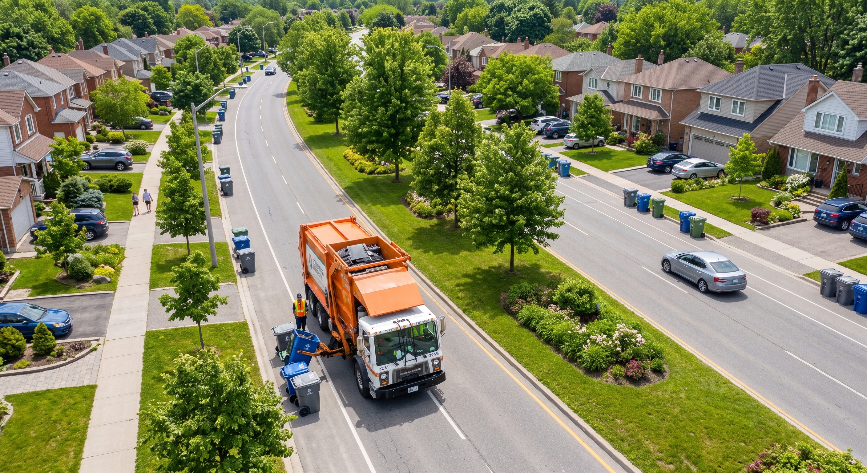
Consumer navigation drops you at "the address." It snaps your destination to the nearest road centerline and calls it done. For a driver in a car, that's fine. Walk across the street.
For a rear-loader on a four-lane arterial or a sanitation route, it isn't fine.
HERE routing lets you control this directly with two settings:
sideOfStreetHint is a coordinate placed a few meters off the centerline on the correct side, usually straight out of a precise geocoder. It tells the router which curb you actually mean.
matchSideOfStreet decides how hard the router enforces it. The default only forces curb alignment when a median physically prevents crossing. Set it to always, and the router will route a legal loop or an intersection turn to put the destination on the driver's side, every time, divided road or not.
For waste collection, street sweeping, meter work, and high-density delivery, this one parameter is the difference between a route a crew will actually run and a route they'll quietly override on day two.
Serving You
How ADCi Saves Your Budget & Sanity
- Get the right solution. Routing is complex and HERE has you covered in many different ways. We help you navigate the options and get you the right solution for your use case, saving you time and making sure you don't buy a semi when all you need is a pickup truck.
- Licensing Options You Won't Find Online. Even if you're running the same APIs you can get self-service, there may be licensing options that can save you money based on your use case or volume. We will help you find the budget savings.
Try Self-Service, License from ADCi
If you're the type of person who just needs to roll up your sleeves and play with the tools to know what you need AND what you need is likely the HERE Routing API, go sign up for the free tier and start calling some endpoints. Even easier, you can contact us and we'll get you set up with access. You don't need a partner to evaluate an API, and we get that.
Test some routes, see what constraints and datapoints are available. Play, learn, and solve problems.
Just be sure to come find us when the evaluation ends and the project starts. Finding the right API endpoint and getting the right licensing are two different problems. We're here to help with both, but we get it if you only need us for the licensing part.
The licensing available self-service is only a portion of the options available and ADCi can often save you money if you buy through us.
Regardless, it will never cost you anything to buy through ADCi and you now have someone to call when you need help understanding or reducing your costs.
Bring your use case.
Leave with a plan.
When you work with ADCi, you have a partner working with you to ensure that you get what you need and nothing more, structured in a way that maximizes your data while minimizing your investment.
HERE's catalog is deep and dense, and selecting the wrong product will burn budget quickly. We've more than likely addressed your use case with a different customer and we'll tell you when the cheaper option is the right one.